top of page

Map (GIS) Gallery
 |  |  |
|---|---|---|
 Typography practice for GIS Communication |  Land Cover and Topography practice for GIS Communication |  Typography practice for GIS Communication |
 Cartography practice for GIS Communication |  Typography practice for GIS Communication |  Projection practice for GIS Communication |
 ArcGIS Online map created with ArcGIS Collector representing the Clearwater Beach lifeguard stations and their condition. |  Geoprocessing model created for GIS Programming course at UWF. |  Computer cartography map representing precipitation amounts in Washington state over a specified amount of time. |
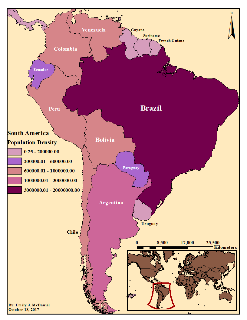
 Another map created in computer cartography, which shows how much wine is consumed in different areas of Europe. |  A map depicting a Washington DC district's schools, including their type and geographic location. |  A map created to compare different results from selecting different data classifications in ArcGIS Pro. |
 One of my favorite maps created during my computer cartography course at UWF. |  Recently, I used the NOAA Storm Database to create a map depicting severe weather events in Pinellas County from 2012-2018. | 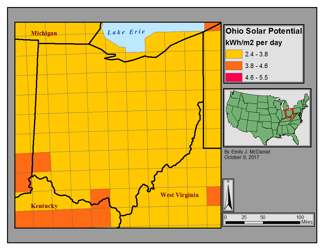 First map I ever created! Assigned in Geographic Information Systems (GIS) course for Environmental Studies Major at Eckerd College. |
 Created for practice using Fields, ArcToolbox, Labels, and correct Projections - something I have improved on since then! | 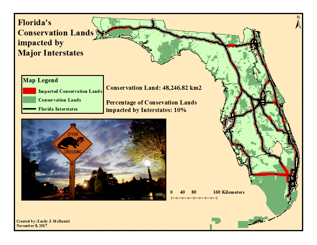 Florida highways intercepting conservation lands present a concern for the safety of wildlife. Used open source information with buffers to track areas of concern. | 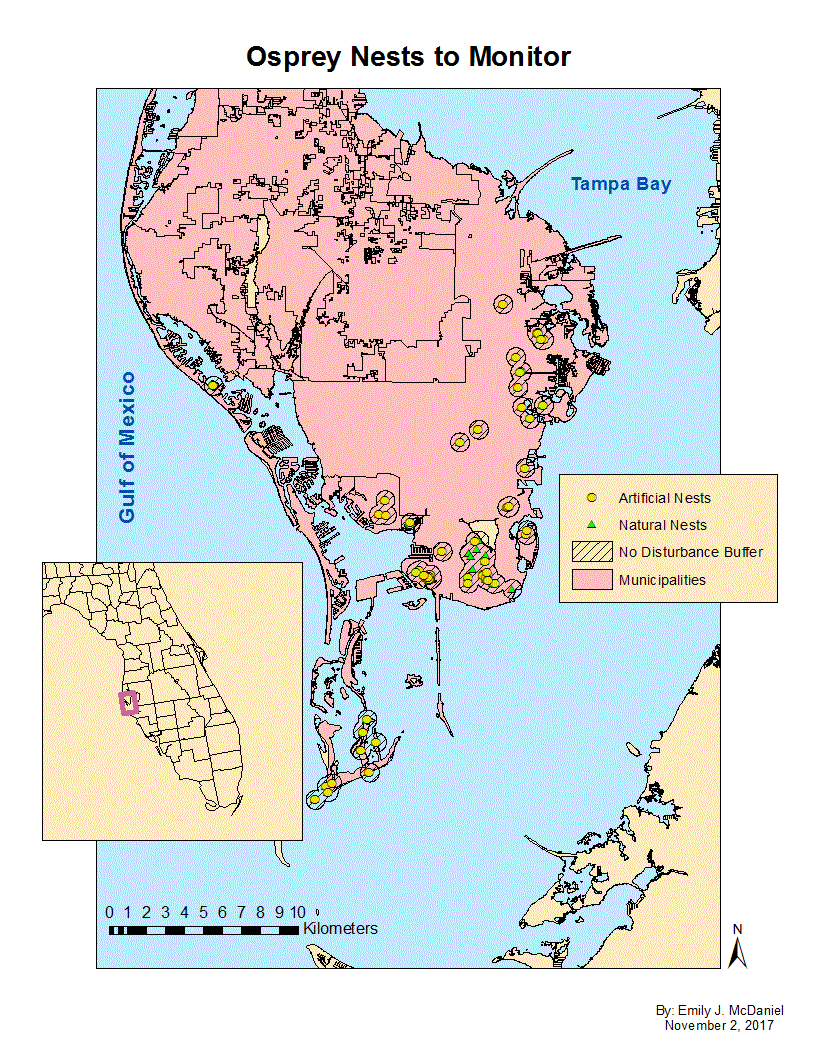 Created for a practical exam: GPS used to mark osprey nests for research and observation. |
 Reclassified raster map showing high densities of threatened and endangered species for designating supportive habitat where the Akeke'e bird species may thrive on the Hawaiian Island of Kauai. | 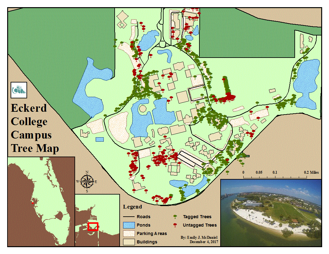 Collected GPS data of tagged versus untagged trees on the Eckerd College campus, as part of the Arbor Program. |  As an extra credit assignment, I created a model to assist with analysis of Florida's snail habitats. |
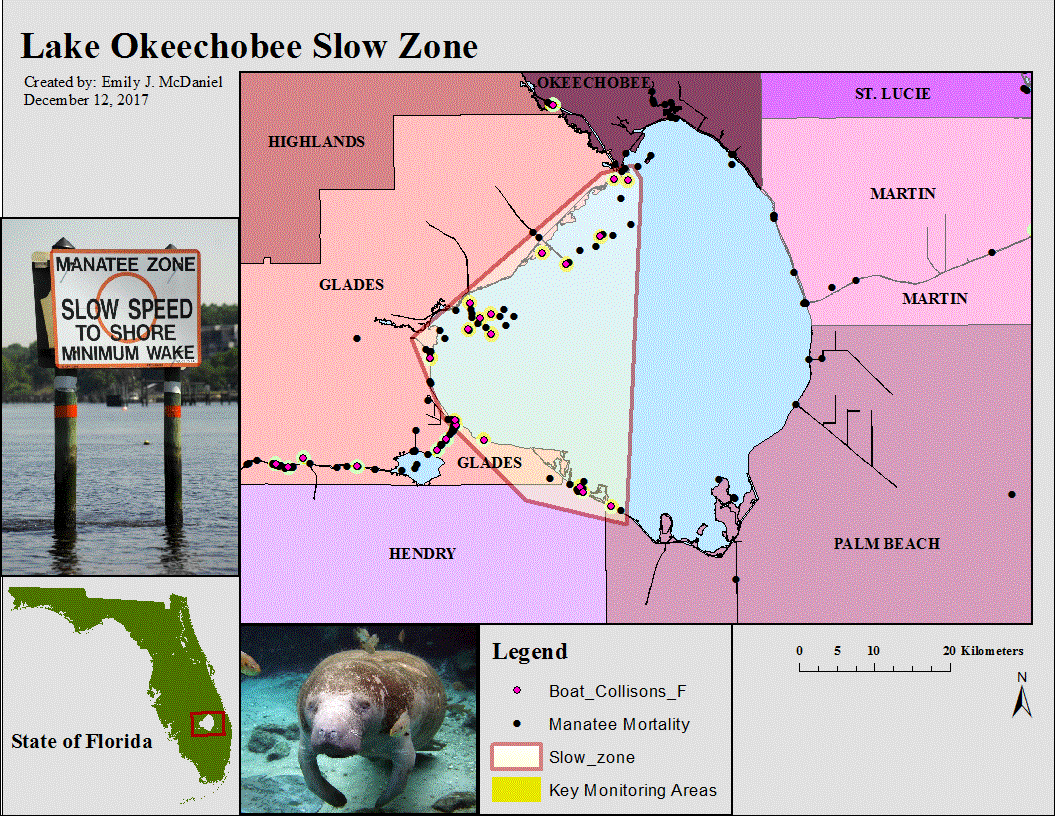 Map created for a "timed final practical exam" that pinpointed female manatee mortalities caused by boat impacts, to designate helpful slow speed zones. |  Map made for mini-project in order to distinguish field management areas for marine mammals in the State of Florida. |  Outreach-style map created to show where manatees were spotted during an aerial survey. |
 Confirmed dolphin strandings along Southwest Florida from 2005-2014, created from data collected by the Fish and Wildlife Research Institute. | 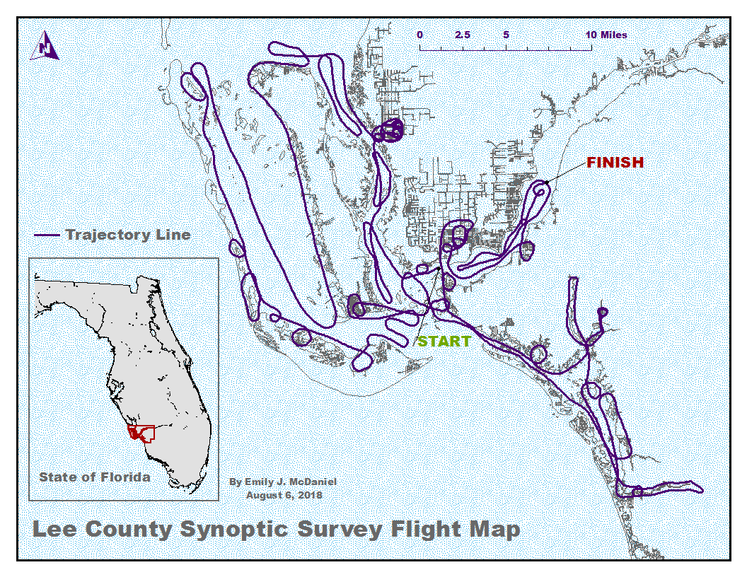 This map represents the accurate path of a aerial survey in Lee County, Florida to observe manatees in warm water regions during a cold front. |
underwater photography gallery
 Three Sisters Springs, Crystal River, Florida. Published 'Save the Manatee Club' calendar photo from 2012. |  Three Sisters Springs, Crystal River, Florida |  Hunter's Springs, Crystal River, Florida |
|---|---|---|
 House Spring, Crystal River, Florida |  Kings Bay, Crystal River, Florida |  Key Largo, Florida |
 Kings Bay, Crystal River, Florida |  Hunter's Spring, Crystal River, Florida |  Hunter's Spring, Crystal River, Florida |
 Kings Bay, Crystal River, Florida |  Kings Bay, Crystal River, Florida |  Key Largo, Florida |
general Photography Gallery
 Vinalas, Cuba |  Trinidad, Cuba |  Vinalas, Cuba |
|---|---|---|
 Playa Larga, Cuba |  Kings Bay, Crystal River, Florida |  Orlando, Florida |
 Blue Spring State Park, Orange City, Florida |  Ponce Inlet, Florida |  Rehabilitating in Florida |
 Photoshop fun in Orlando, Florida |  Blue Spring State Park, Orange City, Florida |  Orlando, Florida |
bottom of page